NASA’s remotely piloted Global Hawk 872 departed the Wallops Flight Facility in Virginia at 7 a.m., August 26, for a 24 hour flight to study Tropical Storm Erika, located just east of the Leeward Islands. The aircraft is carrying instruments to measure temperature, moisture, wind speed and direction as part of the NOAA- led mission Sensing Hazards with Operational Unmanned Technology (SHOUT). The real-time data will go into the National Weather Service forecast models at the National Hurricane Center.
News
NASA's OMG Mission Maps Greenland's Coastline
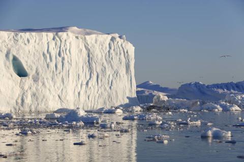
NASA's Oceans Melting Greenland (OMG) field campaign is gathering data that will help scientists both to understand how the oceans are joining with the atmosphere in melting the vast ice sheet and to predict the extent and timing of the resulting sea level rise.
NASA Aircraft to Begin NOAA Hurricane Mission

NASA’s remotely piloted Global Hawk aircraft will begin flights this week in support of a NOAA-led mission to improve hurricane track and intensity forecasts.
California Drought Causing Valley Land to Sink

The California Department of Water Resources today released a new NASA report showing land in the San Joaquin Valley is sinking faster than ever before, nearly 2 inches (5 centimeters) per month in some locations.
Flight Campaign Studies Radar Detection of Ice Crystal Icing

NASA researchers will be flying a DC-8 research plane, outfitted with state-of the-art radar and sophisticated meteorological probes to detect ice crystal icing conditions.
DC-8 Reaches Milestone

NASA's DC-8 Flying Laboratory recently reached its third decade of delivering groundbreaking science.
Alaska's Biggest (Ice) Losers are Inland

Airborne surveys of southern Alaska have helped scientists get a better handle on where ice is being lost from this heavily glaciated region.
NASA Takes to Kansas Skies to Study Nighttime Thunderstorms

NASA has joined a multi-agency field campaign studying summer storm systems in the U.S. Great Plains to find out why they often form after the sun goes down instead of during the heat of the day.
Students Study Earth from NASA Flying Laboratory
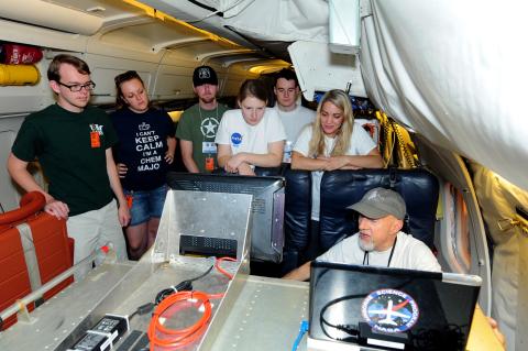
Thirty-two undergraduate students are participating in an eight-week NASA Airborne Science field experience designed to immerse them in the agency's Earth science research.
Operation IceBridge Concludes 2015 Arctic Campaign

Operation IceBridge wrapped up its seventh Arctic deployment on May 21, when NASA’s C-130 research aircraft with the mission’s researchers and instruments on board departed Thule Air Base in Greenland and headed to NASA's Wallops Flight Facility in Virginia.
NASA Study Shows Antarctica’s Larsen B Ice Shelf Nearing Its Final Act

A new NASA study finds the last remaining section of Antarctica's Larsen B Ice Shelf, which partially collapsed in 2002, is quickly weakening and likely to disintegrate completely before the end of the decade.
NASA Airborne Mission to Study Polar Winds

NASA’s DC-8 aircraft began a series of science flights based out of Keflavik, Iceland, on May 11 aimed at studying Arctic polar winds.
New Mission to Provide Snapshot of ‘Average’ Atmosphere

A new NASA Earth Venture mission called the Atmospheric Tomography Mission (ATom) aims to provide a snapshot of the average atmosphere. ATom will systematically measure reactive gases and aerosols over the Atlantic and Pacific Oceans, where the atmosphere is relatively clean and sensitive to change.
NASA ER-2 Completes Suomi-NPP Arctic Validation Mission

NASA’s high-altitude ER-2 aircraft completed a series of validation flights last month in support of the Earth-observing NASA/NOAA Suomi National Polar-orbiting Partnership satellite, or Suomi NPP. The campaign was jointly sponsored by NASA and NOAA and based out of Keflavik, Iceland conducting science flights between March 7 to 31, 2015.
IceBridge Overflies Norwegian Camp On Drifting Sea Ice

Operation IceBridge successfully overflew a drifting Norwegian research vessel locked into the sea ice in the Fram Strait during its first flight of the 2015 Arctic field season.
Operation IceBridge Debuts Its Seventh Arctic Campaign

NASA's Operation IceBridge, an airborne survey of polar ice, successfully completed its first Greenland research flight of 2015 on March 19, thus launching its seventh Arctic campaign. This year’s science flights over Arctic sea and land ice will continue until May 22.
UTexas-NASA Study Sees New Threat to East Antarctic Ice
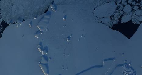
Researchers have discovered two seafloor troughs that could allow warm ocean water to reach the base of Totten Glacier, East Antarctica's largest and most rapidly thinning glacier.
NASA and Partners begin 2015 CAST ATTREX Mission
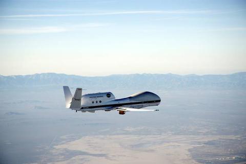
NASA scientists will study the movement of water vapor and greenhouse gases in the tropical tropopause region during this year's CAST ATTREX Mission
NASA Brings the Spirit of Adventure into the Classroom

Across the United States and around the world, students now can participate in deployed NASA Airborne Science Missions.
NASA Aircraft, Spacecraft Aid Atmospheric River Study
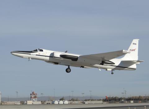
NASA is part of a major field campaign studying intense atmospheric river storms from the ocean, land, air and space.
NASA Hurricane Mission Connects to K-12 Classrooms
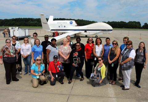
The HS3 team shared the excitement of their scientific mission with K-12 students and teachers across the United States through summer teacher workshops, educator days at NASA Wallops, in-person classroom visits by mission personnel, live remote classroom chats and flight/hurricane tracking.
NASA Data Peers into Greenland’s Ice Sheet
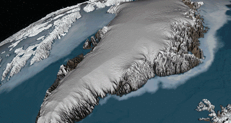
Scientists using ice-penetrating radar data collected by NASA’s Operation IceBridge and earlier airborne campaigns have built the first-ever comprehensive map of layers deep inside the Greenland Ice Sheet.
NASA Airborne Science Aircraft Monitoring the Environment

Climate scientists are using NASA's flying assets to gather information about how the global Earth system is changing and how it is predicted it may change in the future.
West Antarctic Melt Rate Has Tripled: NASA-UC Irvine

Airborne measurements along with data from satellite observations and other sources shows that the melt rate of portions of West Antarctica has tripled in the last 10 years.
HS3 Hurricane Mission Investigated Four Tropical Cyclones in 2014
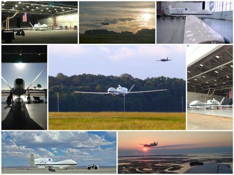
NASA's Hurricane and Severe Storm Sentinel, or HS3, mission investigated four tropical cyclones in the 2014 Atlantic Ocean hurricane season: Cristobal, Dolly, Edouard and Gonzalo. The storms affected land areas in the Atlantic Ocean Basin and were at different stages during the investigations.
NASA Airborne Campaigns Tackle Climate Questions from Africa to Arctic
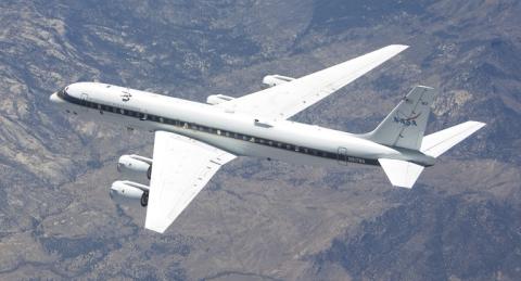
Five new NASA airborne field campaigns will take to the skies starting in 2015 to investigate how long-range air pollution, warming ocean waters, and fires in Africa affect our climate.
IceBridge 2014 Antarctic Campaign Concludes
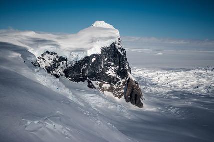
NASA’s Operation IceBridge completed four more surveys of the Antarctic, bringing the mission’s six-week-long field campaign to a close.
NASA: Alaska Shows No Signs of Rising Arctic Methane

Despite large temperature increases in Alaska in recent decades, a new analysis of NASA airborne data finds that methane is not being released from Alaskan soils into the atmosphere at unusually high rates, as recent modeling and experimental studies have suggested. The new result shows that the changes in this part of the Arctic have not yet had enough impact to affect the global methane budget.
Visitors Fly with NASA’s Operation IceBridge

NASA’s Operation IceBridge hosted two high-profile visitors, U.S. Ambassador to Chile Michael Hammer and NASA Chief Scientist Ellen Stofan.
USS Constellation and Thurston Island
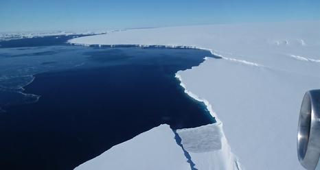
NASA’s Operation IceBridge collected some rare images on a flight out of Punta Arenas, Chile on a science flight over western Antarctica dubbed Ferrigno-Alison-Abbott 01.

