Aircraft List

The NASA Airborne Science Program provides a unique set of NASA supported aircraft that benefit the earth science community. These manned and unmanned aircraft carry the sensors that provide data to support and augment NASA spaceborne missions.

Reminder: All investigators with approved or pending proposals from the Research Opportunities in Space and Earth Sciences (ROSES) announcements that have a requirement for a NASA Airborne Science platform/instrument, must submit a Flight Request. The Flight Request is also the method to acquire an estimate if your proposal requires a cost estimate for Airborne Science support. However, for investigators proposing to participate on large, multi-aircraft experiments, a single Flight Request will be submitted for each mission by the Project Manager or Project Scientist. The Science Operations Flight Request System (SOFRS) can be reached directly at https://airbornescience.nasa.gov/sofrs.

Non-NASA Aircraft
NASA instrumentation may fly on non-NASA Federal aircraft as well as academic and commercial platforms for which agreements for access by SMD investigators are in place, in process, or have recently been approved by NASA Aviation Management as airworthy and safe to operate. For more information, please review the current ASP Call Letter for further requirements and guidance. Please note that in addition to filing the required Flight Request, investigators are responsible for contacting vendors to determine if the platform meets the requirements of the proposed scientific investigation. It is also the responsibility of the investigator to ensure that before any preliminary test flights or actual data collection flights utilizing NASA personnel, instruments or funds occur, all vendors successfully complete a NASA airworthiness/flight safety review in accordance with NASA Aviation Safety Policy for Non-NASA Aircraft.

SIERRA - ARC

NASA SIERRA UAS at McMillan Airfield, Camp Roberts, CA
Current Status:
Open

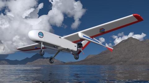
The Sensor Integrated Environmental Remote Research Aircraft (SIERRA) is a medium-class, unmanned aircraft system (UAS) that can perform remote sensing and atmospheric sampling missions in isolated and often inaccessible regions, such as over mountain ranges, the open ocean, or the Arctic/Antarctic. UAS missions are of particular value when long flight durations or range-measurement requirements preclude a human pilot or where remote or harsh conditions place pilots and high-value aircraft at risk. Designed by the U.S. Naval Research Laboratory and developed at NASA's Ames Research Center, the SIERRA is well suited for precise and accurate data collection missions because it is large enough to carry up to 110 pounds of scientific instruments and fly up to 13,000 feet, yet small enough not to require a large runway or hangar.

The SIERRA Program, managed at NASA's Ames Research Center, is focused on providing end-to-end support for UAS flight missions in support of Earth science research and applications activities. The program has capabilities to support all phases of UAS missions, including experiment design, requirements definition, payload integration design and support, airworthiness and flight safety reviews, airspace access including COA development, deployment planning, mission planning and flight operations.

SIERRA-B completed flight qualification and began working with Payloads in November 2018.

Example: A 63 lb. payload can cruise at 60 knots at 1,000 feet for 8.8 hours.

Owner/Operator: 
NASA Ames Research Center
Type: 
UAS
Duration: 
9.0 hours (payload and weather dependent)
Useful Payload: 
110 lbs
Gross Take-off Weight: 
480 lbs
Onboard Operators: 
0
Max Altitude: 
13,000 ft.
Air Speed: 
60 knots
Range: 
520 Nmi
Power: 
16 Amps @ 24 V DC
Point(s) of Contact: 

Dan Weishaar

Work: (650) 604-5495
Individual Aircraft Details: 

N701NA (NASA701) based at ARC