
Annotated water vapor weather satellite image
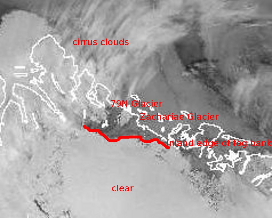
A zoomed-in and annotated version of this morning's 3-micron "water vapor" satellite image, showing northeast Greenland centered on Zachariae and 79N Glaciers. The 3-micron wavelength is very sensitive to the presence of water vapor, and is thus suitable for identifying most forms of ground fog, including the fog present in this image. Clouds and fog saturated with water vapor appear as shades of black or dark gray, and in this case the fog perfectly fills in the topographic contours of Zachariae and 79N Glaciers as it clings to their lower portions. Note that high-altitude cirrus clouds consist not of water vapor but of tiny ice crystals, and thus look very different from fog in this image.
Credits:
Environment Canada
Subject:
Mission: