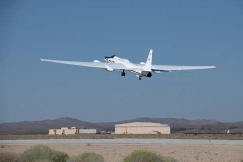
The breeze across the California desert kicks up some dust and sand. As a NASA research plane rolls down the runway and prepares for takeoff, its wings vibrate with the gust of wind. It’s a flight day for one of NASA’s most expansive and complex field campaigns.
News
Validating PACE and Inspiring Future Scientists

This story is from one of 63 virtual student engagement events held for NASA’s Plankton, Aerosol, Cloud, ocean Ecosystem Postlaunch Airborne Experiment (PACE-PAX). The mission used aircraft (the NASA ER-2 and CIRPAS Twin Otter) and waterborne research vessels (R/V Blissfully,R/V Shearwater, and R/V Fish) to calibrate and validate the data from the PACE satellite, which was launched in February 2024. California was the main hub for the mission, with most of the airborne and waterborne activities occurring in Edwards, Marina, Long Beach, and Santa Barbara.
Twenty-one Hours a Day on a 30-Foot Floating Science Lab
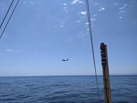
Research Vessel (RV) Blissfully is a 30-foot sailboat that is the science lab and home for two sailing scientists, Captain Gordon Ackland and myself, Dr. Bridget Seegers. The RV Blissfully is a recent addition to the fleet of research vessels. Previously, Blissfully’s days were primarily spent peacefully floating snug in a San Diego boat slip with an occasional day sail. However, Blissfully was volunteered to support the PACE-PAX campaign and therefore transitioned a month ago into RV Blissfully.
Day-in-the-Life of a PACE-PAX Mission Flight
06:00 Local Time: Go/No-Go Meeting We are in the field supporting PACE-PAX (Plankton, Aerosol, Cloud, ocean Ecosystem Postlaunch Airborne eXperiment), a multi-disciplinary mission that involves two aircraft—the NASA ER-2 and CIRPAS Twin Otter—and several mobile ocean assets, all helping to validate observations and data products from NASA’s new satellite observation platform, PACE. Our days typically start with an initial look at the weather in the area of operations and airport conditions during takeoff and landing. Both the ER-2 and Twin Otter will fly today since the weather is acceptable for launch, science, and landing.
Sailing Away for PACE
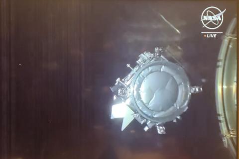
Hello from sunny Santa Barbara, California, where the ship operations for the PACE-PAX campaign are underway!
The PACE satellite went into orbit in February 2024. Its mission is to help us better understand how the ocean and atmosphere exchange carbon dioxide, as well as how aerosols can fuel phytoplankton blooms and help us track harmful algal blooms around the planet.
PACE-PAX stands for Plankton, Aerosol, Cloud, ocean Ecosystem – Postlaunch Airborne eXperiment (see why we made it shorter?) We are using two airplanes and three ships, among other free-sailing instruments, to gather data that will tell us how well our shiny new satellite, PACE, is doing. We compare our planet-side data with the space-side data so we can make sure we are providing the very best information about the health of the world’s oceans.
NASA Earth Scientists Take Flight, Set Sail to Verify PACE Satellite Data

NASA - More than 100 scientists will participate in a field campaign involving a research vessel and two aircraft this month to verify the accuracy of data collected by NASA’s new PACE satellite: the Plankton, Aerosol, Cloud, ocean Ecosystem mission.
NASA G-IV Plane Will Carry Next-Generation Science Instrument
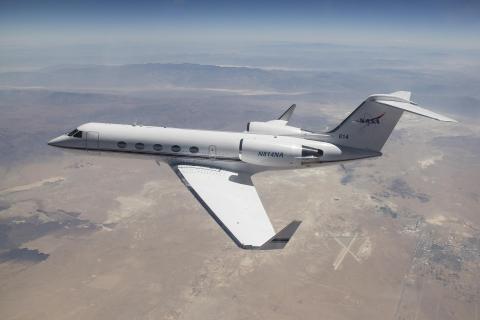
In June 2024, a new tail number swept the sky above NASA’s Armstrong Flight Research Center in Edwards, California. Pilots conducted flights of a Gulfstream IV (G-IV) to evaluate its handling characteristics and to familiarize pilots with it before it begins structural modifications. The research plane is joining the center’s fleet serving NASA’s Airborne Science program.
NASA Aircraft Gathers 150 Hours of Data to Better Understand Earth
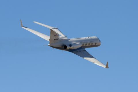
Operating internationally over several countries this summer, NASA’S C-20A aircraft completed more than 150 hours of science flights across two months in support of Earth science research and overcame several challenges throughout its missions.
NASA Returns to Arctic Studying Summer Sea Ice Melt
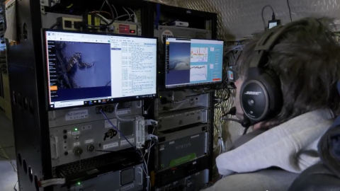
The NASA-sponsored Arctic Radiation Cloud Aerosol Surface Interaction Experiment (ARCSIX) mission is flying three aircraft over the Arctic Ocean north of Greenland to study these processes. The aircraft are equipped with instruments to gather observations of surface sea ice, clouds, and aerosol particles, which affect the Arctic energy budget and cloud properties. The energy budget is the balance between the energy that Earth receives from the Sun and the energy the Earth loses to outer space.
Second Stop: The 2019 Arctic Tundra Fire in Greenland

First Stop: Sampling the 2023 Fires in Quebec
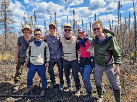
This blog post is the first in a series to come. Our team, the Climate & Ecosystems Change research group from the Vrije Universiteit Amsterdam, is working in collaboration with the Environmental Change Research Unit from the University of Helsinki for a summer with lots of fire field work, science, and adventure. On this journey, our first stop was the Quebec province in Canada. I’m writing this post after our last day of fieldwork here.
NASA-Led Mission to Map Air Pollution Over Both U.S. Coasts
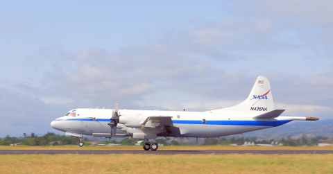
This summer between June 17 and July 2, NASA will fly aircraft over Baltimore, Philadelphia, parts of Virginia, and California to collect data on air pollutants and greenhouse gas emissions. The campaign supports the NASA Student Airborne Research Program for undergraduate interns.
NASA Mission Flies Over Arctic to Study Sea Ice Melt Causes
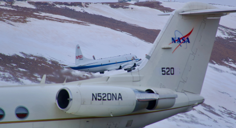
It’s not just rising air and water temperatures influencing the decades-long decline of Arctic sea ice. Clouds, aerosols, even the bumps and dips on the ice itself can play a role. To explore how these factors interact and impact sea ice melting, NASA is flying two aircraft equipped with scientific instruments over the Arctic Ocean north of Greenland this summer. The first flights of the field campaign, called ARCSIX (Arctic Radiation Cloud Aerosol Surface Interaction Experiment), successfully began taking measurements on May 28.
NASA Teammates Recall Favorite Memories Aboard Flying Laboratory
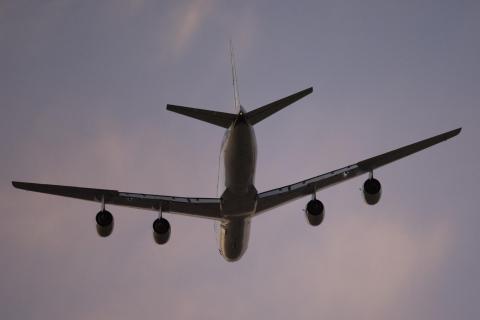
After flying more than three decades and 158 science campaigns, just one flight remains. NASA’s DC-8 Airborne Science Laboratory will make its final flight May 15 to Idaho State University in Pocatello, Idaho, where it will be used to train future aircraft technicians by providing real-world experience in the college’s Aircraft Maintenance Technology Program.
Meet NASA Women Behind World’s Largest Flying Laboratory
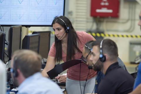
NASA’s DC-8 aircraft – the world’s largest flying science laboratory – began its science missions in 1987 and since then, has flown in service of the science community over places like Antarctica, Greenland, and Thailand. Aircraft like the DC-8 have enabled scientists to ask questions about life on Earth and explore them in a way that only NASA’s Airborne Science program can make happen. After 37 years, the DC-8 will retire to Idaho State University, where it will serve as an educational tool for students.
As the DC-8 approaches its retirement, we highlight five of the women who have made the aircraft and program a success. Kirsten Boogaard, Nicki Reid, Carrie Worth, Erin Waggoner, and Wendy Bereda of NASA’s Armstrong Flight Research Center in Edwards, California, are building the legacy of women who are helping pave the way for the next generation.
NASA’s ORCA, AirHARP Projects Paved Way for PACE to Reach Space
It took the Plankton, Aerosol, Cloud, ocean Ecosystem (PACE) mission just 13 minutes to reach low-Earth orbit from Cape Canaveral Space Force Station in February 2024. It took a network of scientists at NASA and research institutions around the world more than 20 years to carefully craft and test the novel instruments that allow PACE to study the ocean and atmosphere with unprecedented clarity.
NASA Selects New Aircraft-Driven Studies of Earth and Climate Change
NASA has selected six new airborne missions that include domestic and international studies of fire-induced clouds, Arctic coastal change, air quality, landslide hazards, shrinking glaciers, and emissions from agricultural lands. NASA’s suite of airborne missions complement what scientists can see from orbit, measure from the ground, and simulate in computer models.
Hazy Skies in a Growing City

Chiang Mai, the largest city in northern Thailand, is famed for having hundreds of Buddhist temples, some of which date to the city’s founding in the 13th century. This rich history—and easy access to hiking, waterfalls, and hot springs in the surrounding highlands, as well as being the setting of a hit movie in 2012—has turned the city into a hub of tourism that hosts as many as 10 million visitors per year.
Grappling with Thailand’s Seasonal Haze

Each year in January and February, satellites begin to detect waves of smoke and fire in Southeast Asia, particularly in highland forests in Cambodia, Laos, Myanmar, and Thailand. Fire activity continues to increase through March and April, reaches a peak during the height of the dry season, and then fades in May with the start of the rainy season.
Individual fires are usually small and short-lived. But they are often so numerous that smoke, along with air pollution from rural and urban areas, mixes to produce thick layers of haze that blanket the landscape. Such hazes contain mixtures of small airborne particles called aerosols and gaseous pollutants such as nitrogen dioxide, sulfur dioxide, carbon monoxide, and ozone that degrade air quality and have harmful health effects.
In spring 2024, an international field campaign—ASIA-AQ (Airborne and Satellite Investigation of Asian Air Quality)—headed to Thailand to take a close look at the haze. During the last two weeks of March 2024, NASA’s DC-8 and Gulfstream III aircraft flew several flights over Chiang Mai, Bangkok, and rural areas surrounding the cities to sample air quality with several sensors. At the same time, satellites observed the haze from above.
NASA’s DC-8 Completes Final Mission, Set to Retire
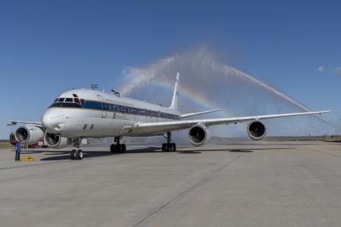
After 37 years of successful airborne science missions, NASA’s DC-8 aircraft completed its final mission and returned to the agency’s Armstrong Flight Research Center Building 703 in Palmdale, California, on April 1.
Langley Celebrates Women’s History Month: The Langley ASIA-AQ Team
In honor of Women’s History Month, we caught up with the ASIA-AQ team on the other side of the Earth and asked the women from Langley about their inspirations and challenges as scientists. The ASIA-AQ (Airborne and Satellite Investigation of Asian Air Quality) mission is an international cooperative field study designed to address local air quality challenges. ASIA-AQ will contribute to improving the integration of satellite observations with existing air quality ground monitoring and modeling efforts across Asia.
NASA Leader Casey Swails Learns About Wildfire Work at NASA Ames
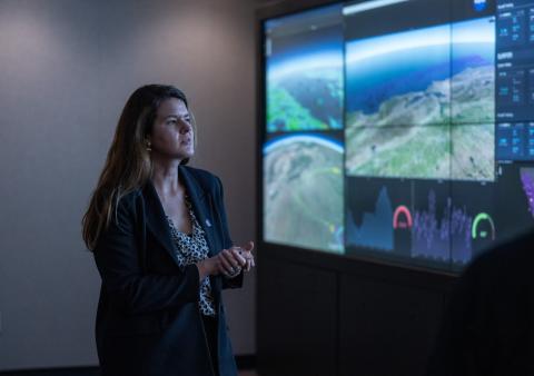
NASA Deputy Associate Administrator Casey Swails views a demonstration on screen in the Airspace Operations Laboratory at NASA’s Ames Research Center in California’s Silicon Valley. Researchers presented the diverse, long-running efforts in aeronautics at Ames that have helped lay the foundation for agency work related to wildfire response.
NASA Collaborates in an International Air Quality Study
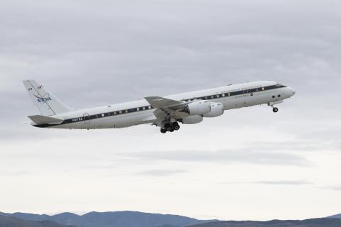
NASA and international researchers are studying the air quality in Asia as part of a global effort to better understand the air we breathe. In collaboration with Korea’s National Institute of Environmental Research (NIER), the Airborne and Satellite Investigation of Asian Air Quality, or ASIA-AQ mission, will collect detailed atmospheric data over several locations in Asia.
NASA’s DC-8 to Fly Low-Altitude Over Central Valley, CA
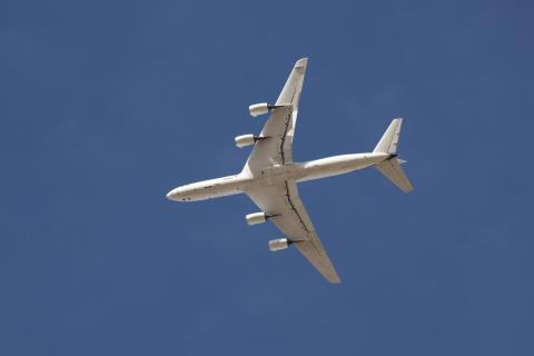
NASA Armstrong Flight Research Center’s DC-8 aircraft will fly over Central Valley and surroundings areas as part of an air quality field study. Residents in the areas below will see and hear the aircraft as it flies to achieve these measurements.
NASA Helps Study One of the World’s Most Diverse Ecosystems
NASA satellite and airborne tools aid an international team studying biodiversity on land and in the water around South Africa. An international team of researchers spent October and November 2023 in the field studying one of the world’s most biologically diverse areas – South Africa’s Greater Cape Floristic Region. As part of the effort, researchers used NASA airborne and space-based instruments to gather complementary data to better understand the unique aquatic and terrestrial ecosystems in this region. Their findings will inform the capabilities of future satellite missions aimed at studying plants and animals.
NASA, Partners Explore Sustainable Fuel’s Effects on Aircraft Contrails
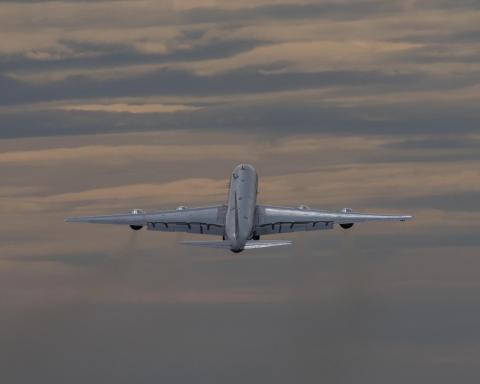
Contrails, the lines of clouds from high-flying aircraft that crisscross the skies, are familiar sights, but they may have an unseen effect on the planet – trapping heat in the atmosphere. Working with Boeing, and other partners, NASA researchers are collecting data to see how new, greener aviation fuels can help reduce the problem.
A Tale of Three Pollutants
It was a hazy August day on Chicago’s South Side, and Nedra Sims Fears was hosting a small gathering to talk about the air. Interstate-94, which bisects her Chatham neighborhood, hummed nearby. “This was the summer I spent watching summer out my window,” Fears said.
That’s because asthma runs in her family, and smoke from wildfires in Canada had wafted into Chicago, making it difficult for her to breathe. Many of her neighbors don’t have air conditioning, which means they don’t have the luxury of shutting their windows against the tiny hazardous particles contained in the smoke.
Several thousand feet above the Fears’ home, one of the largest flying laboratories in the world circled the skies over Chicago. The plane – NASA’s four-engine DC-8 jet – is a storied research craft. Over the past 25 years it has supported field campaigns across all seven continents. On this August 2023 day, it carried 40 researchers and a pack of scientific instruments investigating air pollution over the cities and pasturelands of the Midwest.
NASA Ames’ Contributions to OSIRIS-REx

NASA’s Langley Research Center in Hampton, Virginia, will manage an experiment taking advantage of the OSIRIS-REx sample arrival to study characteristics of re-entry through an atmosphere. Four aircraft and teams at three ground sites will track the capsule’s trajectory on its way to the surface, using imaging and spectroscopy instruments. Data from the project, called Hypervelocity OSIRIS-REx Reentry Imaging & Spectroscopy (HORIS), will be used to validate and develop planetary entry models. NASA’s Earth Science Project Office (ESPO), based at Ames, will provide operational and shipping support to two international ground teams by setting up work sites at three different locations in northern Nevada.
Surf, Turf, Above Earth: Students Participate in NASA Field Research
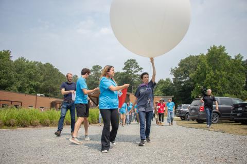
Flying over and tromping through watery landscapes along the East Coast, working alongside NASA scientists, and recording measurements about the air that they’re travelling through – these are not the usual experiences for an undergraduate student. For the 2023 participants in NASA’s SARP East program – short for Student Airborne Research Program – it was part of a summer they won't forget.
NASA Student Airborne Research Program 2023: Sky-High Science Learning
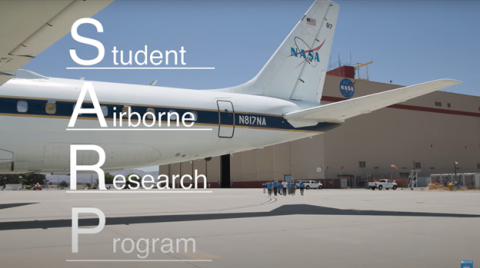
NASA’s Armstrong Flight Research Center hosted undergraduate students for the 2023 Student Airborne Research Program. An eight-week summer internship program, SARP offers upper-level undergraduate students the opportunity to acquire hands-on research experience as part of a real scientific campaign. This year SARP, the Student Airborne Research Program, celebrated 15 years of success in the Airborne Science Program. Students worked alongside scientists and aircraft professionals both on the ground and in the sky, using NASA Airborne Science Program’s flying science laboratories, like NASA Armstrong’s DC-8 aircraft. Outfitted specifically for science research projects, aircraft like the DC-8 help support both students and mission personnel to investigate science questions, aid in the understanding of our environment, and improve life on Earth.
Learn more about SARP: https://baeri.org/sarp/

