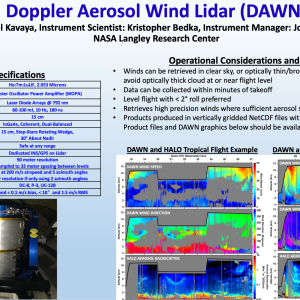
The NASA Langley Research Center DAWN (Doppler Aerosol WiNd) lidar system employs a pulsed, solid-state laser operating at 2053 nm wavelength. It pulses at 10 Hz with up to 100 mJ/pulse which are 180 ns long. Using a wedge scanner, several different azimuth angles can be measured below the aircraft, all at a 30 degree off-nadir angle. Multiple azimuth angles enable horizontal wind calculation, mitigate cloud obscurations, and measure atmospheric variability. DAWN can provide vertical profiles of the zonal (u) and meridional (v) components of the horizontal wind below the aircraft, typically at ~60 meter resolution. Various vertical and horizontal resolutions are possible in post processing. DAWN can also provide vertical profiles of line of sight (LOS) wind speed at each azimuth angle. It can also be operated to stare persistently at any particular azimuth angle to simulate what a satellite such as European Space Agency Atmospheric Dynamics Mission (ADM) Aeolus would observe. DAWN signal returns also permit retrieval of vertical profiles of relative aerosol backscatter, planetary boundary layer height, and wind turbulence.
Doppler Aerosol WiNd Lidar
Instrument Type
Aircraft
Recent Missions
(DC-8 - AFRC);
(DC-8 - AFRC);
(DC-8 - AFRC);
(DC-8 - AFRC);
(DC-8 - AFRC);
(B-200 (UC-12B) - LARC)
Point(s) of Contact
(POC; PI)
Range of Measurement
Vertical profile
Instrument Pointing
Conical scanning
Pointing Angles
30 deg nadir
Measurement Sampling Rate
10.00 Hz
Vertical Resolution
33.00 m
TRL
9
Publications
Kavaya, M.J., et al. (2014), The Doppler Aerosol Wind Lidar (DAWN) Airborne, Wind-Profiling, Coherent-Detection Lidar System: Overview, Flight Results, and Plans, J. Atmos. Oceanic Technol., 34, 826-842, doi:10.1175/JTECH-D-12-00274.1.
Greco, S., et al. (2020), "Polar Winds: Airborne Doppler Wind Lidar Missions in the Arctic for Atmospheric Observations and Numerical Model Comparisons", Atmosphere 11, 11, 1141, doi:10.3390/atmos11111141.
Greco, S., et al. (2020), "Doppler Aerosol WiNd (DAWN) Lidar during CPEX 2017: Instrument Performance and Data Utility", Remote Sensing 12, 18, 2951, doi:10.3390/rs12182951.
Bedka, K.M., et al. (2021), Airborne lidar observations of wind, water vapor, and aerosol profiles during the NASA Aeolus calibration and validation (Cal/Val) test flight campaign, Atmos. Meas. Tech., 14, 4305-4334, doi:10.5194/amt-14-4305-2021.
Groups


