The Atmospheric Tomography Mission (ATom) will study the impact of human-produced air pollution on greenhouse gases and on chemically reactive gases in the atmosphere. Reductions of atmospheric concentrations of methane (CH4), tropospheric ozone (O3) and black carbon (BC) aerosols are effective measures to slow global warming and to improve air quality. Airborne instruments will look at how atmospheric chemistry is transformed by various air pollutants and at the impact on CH4 and O3. Mitigation of these short-lived climate forcers is a major component of current international policy discussions.
ATom deploys an extensive gas and aerosol payload on the NASA DC-8 aircraft for systematic, global-scale sampling of the atmosphere, profiling continuously from 0.2 to 12 km altitude. Flights will occur in each of 4 seasons over a 4-year period. They will originate from the Armstrong Flight Research Center in Palmdale, California, fly north to the western Arctic, south to the South Pacific, east to the Atlantic, north to Greenland, and return to California across central North America. ATom establishes a single, contiguous global-scale data set. This comprehensive data set will be used to improve the representation of chemically reactive gases and short-lived climate forcers in global models of atmospheric chemistry and climate. Profiles of the reactive gases will also provide critical information for validation of satellite data, particularly in remote areas where in situ data is lacking.
ATom’s tomographic, large-scale sampling combined with parcel-by-parcel quantification of photochemical tendencies provides a strong response to the 2011 NASA Strategic Plan to Advance Earth System Science: meeting the challenges of climate and environmental change on a global scale.
ATom improves predictions of human-caused and natural changes in climate forcing and air quality over the entire globe, engaging the science Focus Areas: Atmospheric Composition (primary); Carbon Cycle and Ecosystems (role of CH4), and Climate Variability and Change (radiative forcing of CH4 and O3).
Airborne Missions
Atmospheric Tomography Mission (ATom)

North Atlantic Aerosols and Marine Ecosystems Study (NAAMES)
The North Atlantic Aerosols and Marine Ecosystems Study (NAAMES) is an interdisciplinary investigation resolving key processes controlling marine ecosystems and aerosols that are essential to our understanding of Earth system function and future change. NAAMES is funded by the NASA Earth Venture Suborbital Program and is the first EV-S mission focused on studying the coupled ocean ecosystem and atmosphere.
Plankton ecosystems of the global ocean profoundly affect climate and life on Earth. NASA's ocean color satellite record tells us that these invaluable ecosystems are highly responsive to climate variability, with changes in ocean production impacting food production, uptake of atmospheric carbon dioxide, and emission of climate-regulating aerosols. Intergovernmental Panel on Climate Change (IPCC) simulations suggest that surface ocean temperatures will warm by +1.3 to +2.8 degrees C globally over the 21st century, with major consequences on physical properties of the surface ocean where plankton populations thrive. The pressing question is, how will these changes alter plankton production, species composition, and aerosol emissions? Today, even the sign of these potential changes remains unresolved. Our ability to predict Earth System consequences of a warming ocean and develop realistic mitigation and adaption strategies depends on resolving conflicting hypotheses regarding the factors controlling plankton ecosystems and biogenic aerosol emissions.
NAAMES consists of four, combined ship and aircraft field campaigns that are each aligned to a specific event in the annual plankton lifecycle. Ship-based measurements provide detailed characterization of plankton stocks, rate processes, and community composition. Ship measurements also characterize sea water volatile organic compounds, their processing by ocean ecosystems, and the concentrations and properties of gases and particles in the overlying atmosphere. These diverse data are extended over broader spatial scales through parallel airborne remote sensing measurements and in situ aerosol sampling that target ocean properties as well as the aerosols and clouds above. The airborne data crucially link local-scale processes and properties to the much larger scale continuous satellite record. Integrating the NAAMES observations with state-of-the-art climate and ecosystems models enables the creation of a process-based foundation for resolving plankton dynamics in other ocean regions, accurately interpreting historical satellite records, and improving predictions of future change and their societal impacts.

Hyperspectral Infrared Imager (HyspIRI) Airborne Campaign
The Hyperspectral Infrared Imager or HyspIRI mission will study the world’s ecosystems and provide critical information on natural disasters such as volcanoes, wildfires and drought. HyspIRI will be able to identify the type of vegetation that is present and whether the vegetation is healthy. The mission will provide a benchmark on the state of the worlds ecosystems against which future changes can be assessed. The mission will also assess the pre-eruptive behavior of volcanoes and the likelihood of future eruptions as well as the carbon and other gases released from wildfires.
The HyspIRI mission includes two instruments mounted on a satellite in Low Earth Orbit. There is an imaging spectrometer measuring from the visible to short wave infrared (VSWIR: 380 nm - 2500 nm) in 10 nm contiguous bands and a multispectral imager measuring from 3 to 12 um in the mid and thermal infrared (TIR). The VSWIR and TIR instruments both have a spatial resolution of 60 m at nadir. The VSWIR will have a revisit of of 19 days and the TIR will have a revisit of 5 days. HyspIRI also includes an Intelligent Payload Module (IPM) which will enable direct broadcast of a subset of the data.
NASA will conduct airborne campaigns for the HyspIRI mission. For these campaigns, NASA will fly the Airborne Visible/Infrared Imaging Spectrometer (AVIRIS) and the MODIS/ASTER Airborne Simulator (MASTER) instruments on a NASA ER-2 aircraft to collect precursor datasets in advance of the Hyperspectral Infrared Imager (HyspIRI) mission. The primary goal of this activity is to demonstrate important science and applications research that is uniquely enabled by HyspIRI like data, taking advantage of the contiguous spectroscopic measurements of the AVIRIS, the full suite of MASTER TIR bands, or combinations of measurements from both instruments.
Aerosol Characterization from Polarimeter and Lidar (ACEPOL)
The Aerosol Characterization from Polarimeter and Lidar (ACEPOL) campaign performs aerosol and cloud observations over the Western USA in October and November 2017. It is a collaborative effort among the NASA ACE pre-formulation study and the CALIPSO project as well as the Netherlands Institute for Space Research.
ACEPOL’s objective is to assess the capabilities of proposed future instruments by the ACE pre-formulation study to answer fundamental science questions associated with aerosols, clouds, air quality and global ocean ecosystems. Further, it provides reference data to the ongoing CALIPSO satellite mission. ACEPOL results are also relevant to other satellite missions such as EarthCare, MAIA, METOP-SG, and PACE. In particular, ACEPOL will access retrieval of aerosol and cloud microphysical and optical parameters, as well aerosol layer height.
To achieve the ACEPOL objectives, multiple airborne polarimeters (AirHARP, AirMSPI, AirSPEX, and RSP) and lidars (CPL and HSRL-2) are deployed on NASA’s high altitude ER-2 aircraft to simulate satellite remote sensing observations. The ACEPOL data are quantitatively compared between the different instruments, against ground based reference data (AERONET, GroundMSPI, MPLnet, etc.), and against satellite observations (CATS-ISS, MISR, MODIS, CALIPSO). ACEPOL results will enable the development of novel aerosol and cloud retrieval algorithms by unlocking the full information content provided by the combination of active and passive instruments.
Active Sensing of CO2 Emissions over Nights, Days, & Seasons (ASCENDS)
NASA is honing new carbon dioxide measurement techniques and technologies from onboard its DC-8 aircraft during the Active Sensing of CO2 Emissions over Nights, Days and Seasons (ASCENDS) mission.

Airborne Surface Water and Ocean Topography (AirSWOT)
The Airborne Surface Water and Ocean Topography, or AirSWOT, project uses an interferometer mounted in a NASA King Air B200. The Ka-band radar interferometer will help the science team determine the kinetic energy of the ocean circulation and how the ocean uptake of heat and carbon is being transferred into the atmosphere to verify its effects on climate change. The sensor is also collecting hydrology measurements of the storage changes in terrestrial surface water bodies, soil content depending on seasonal changes, and river discharges into large bodies of water like the ocean.
Convective Processes Experiment (CPEX)
The NASA Convective Processes Experiment (CPEX) aircraft campaign will take place in the North Atlantic Ocean during the summer of 2017. This campaign hopes to collect data that could help to answer questions about convective storm initiation, organization, and growth. For this effort, NASA's DC-8 aircraft will log 100 hours of flight time and be equipped with multiple instruments capable of taking measurements that will help scientists improve their understanding of convective processes.
COral Reef Airborne Laboratory (CORAL)
It is estimated that 33-50% of coral reefs worldwide have been largely or completely degraded (International Society for Reef Studies Consensus Statement, October 2015). Yet the data supporting these predictions are surprisingly sparse, and thereby their relation to the environment is unclear. The COral Reef Airborne Laboratory (CORAL) will pave the way to better predict the future of this global ecosystem and steward them through global change by addressing the question: What is the relationship between coral reef condition and biogeophysical forcing parameters?
CORAL covers the Mariana Islands, Palau, portions of the Great Barrier Reef, and the Main Hawaiian Islands. These regions cover wide ranges of reef type, physical forcing, human threats, and biodiversity.
CORAL will provide the most extensive and uniform picture to date of coral reef condition through the use of the Portable Remote Imaging Spectrometer (PRISM) instrument aboard the Tempus Applied Solutions Gulfstream-IV (G-IV) aircraft. PRISM will record the spectra of light reflected upward toward the instrument from the ocean below. Its very high spectral resolution is then used to identify reef composition (i.e., coral, algae, and sand) and model primary production. In situ data are obtained to validate the remote observations.

KORUS-AQ: Korea-United States Air Quality Study
KORUS-AQ offers the opportunity to further advance NASA goals and those of its international partners related to air quality through a targeted field study focused on the South Korean peninsula and surrounding waters. The study, taking place April-June 2016, will integrate observations from aircraft, ground sites, and satellites with air quality models to understand the factors controlling air quality across urban, rural, and coastal interfaces.
KORUS-AQ Twitter: https://twitter.com/KORUS_AQ

Olympic Mountain Experiment (OLYMPEX)
The Olympic Mountains Experiment (OLYMPEX) is a ground validation field campaign designed to verify and validate satellite measurement of precipitation from the constellation of satellites known as the Global Precipitation Measurement (GPM). The primary goal of OLYMPEX is to validate rain and snow measurements in midlatitude frontal systems moving from ocean to coast to mountains and to determine how remotely sensed measurements of precipitation by GPM can be applied to a range of hydrologic, weather forecasting and climate data. OLYMPEX will have a wide variety of ground instrumentation, and several radars and aircraft monitoring oceanic storm systems as they approach and traverse the Peninsula and the Olympic Mountains. The intensive observing period will be from November 2015 through February 2016.

Carbon in Arctic Reservoirs Vulnerability Experiment (CARVE)
The carbon budget of Arctic ecosystems is not known with confidence since fundamental elements of the complex Arctic biological-climatologic-hydrologic system are poorly quantified. CARVE will collect detailed measurements of important greenhouse gases on local to regional scales in the Alaskan Arctic and demonstrate new remote sensing and improved modeling capabilities to quantify Arctic carbon fluxes and carbon cycle-climate processes. Ultimately, CARVE will provide an integrated set of data that will provide unprecedented experimental insights into Arctic carbon cycling.
CARVE will use the Arctic-proven C-23 Sherpa aircraft to fly an innovative airborne remote sensing payload. It includes an L-band radiometer/radar and a nadir-viewing spectrometer to deliver the first simultaneous measurements of surface parameters that control gas emissions (i.e., soil moisture, freeze/thaw state, surface temperature) and total atmospheric columns of carbon dioxide, methane, and carbon monoxide. The aircraft payload also includes a gas analyzer that links greenhouse gas measurements directly to World Meteorological Organization standards. Deployments will occur during the spring, summer and early fall when Arctic carbon fluxes are large and change rapidly. Further, at these times, the sensitivities of ecosystems to external forces such as fire and anomalous variability of temperature and precipitation are maximized. Continuous ground-based measurements provide temporal and regional context as well as calibration for CARVE airborne measurements.

Airborne Microwave Observatory of Subcanopy and Subsurface (AirMOSS)
The Airborne Microwave Observatory of Subcanopy and Subsurface, or AirMOSS, investigation is gathering high-resolution measurements of root-zone soil moisture in representative areas of North American ecosystems, quantifying the impact of variations in soil moisture on the estimation of regional carbon fluxes, and extrapolating the estimates of regional carbon fluxes to the North American continental scale. AirMoss uses an airborne ultra-high frequency synthetic aperture radar capable of penetrating through substantial vegetation canopies and soil to depths down to 4 feet (1.2 meters). For this mission, NASA's Uninhabited Aerial Vehicle Synthetic Aperture Radar, or UAVSAR, in P-band configuration is mounted in a pod and flown on a NASA G-III.
Plains Elevated Convection At Night (PECAN)
PECAN is a large meteorology experiment sponsored by the National Science Foundation (NSF), the National Oceanic and Atmospheric Administration (NOAA), National Aeronautical and Space Administration (NASA), and the Department Of Energy (DOE). The scientific goal of the project is to collect data before and during nighttime severe storms in order to learn how they form, why some become severe, and how to predict them better.
PECAN will use 8 mobile radars, 3 research aircraft, dozens of mobile weather balloon launching systems, mobile and deployable weather instruments, laser systems, and other cutting-edge targetable instruments to “chase” severe nighttime storms.
Major scientific questions include:
- How do small-scale features in the atmosphere cause and maintain convection after sunset?
- What processes control the intensity and severity of nighttime MCSs?
- What observations are needed to improve forecasts of the formation and evolution of nighttime storms?

Airborne Tropical Tropopause Experiment (ATTREX)
Despite its low concentration, stratospheric water vapor has large impacts on the earth’s energy budget and climate. Recent studies suggest that even small changes in stratospheric humidity may have climate impacts that are significant compared to those of decadal increases in greenhouse gases. Future changes in stratospheric humidity and ozone concentration in response to changing climate are significant climate feedbacks.
While the tropospheric water vapor climate feedback is well represented in global models, predictions of future changes in stratospheric humidity are highly uncertain because of gaps in our understanding of physical processes occurring in the Tropical Tropopause Layer (TTL, ~13-18 km), the region of the atmosphere that controls the composition of the stratosphere. Uncertainties in the TTL chemical composition also limit our ability to predict future changes in stratospheric ozone.
Airborne Tropical TRopopause EXperiment (ATTREX) will perform a series of measurement campaigns using the long-range NASA Global Hawk (GH) unmanned aircraft system (UAS) to directly address these problems.

Arctic Radiation - IceBridge Sea & Ice Experiment (ARISE)
Overall Objective:
Acquire well calibrated data sets using aircraft and surface-based sensors to support the use of NASA satellite and other assets for developing a quantitative process level understanding of the relationship between changes in Arctic ice and regional energy budgets as influenced by clouds.
Specific Objectives:
1. From the NASA C-130, measure spectral and broadband radiative flux profiles, quantify surface characteristics, cloud properties, and other atmospheric state parameters under a variety of Arctic atmospheric and surface conditions (including open water, sea ice, and land ice), and coinciding with satellite overpasses when possible.
2. Acquire detailed measurements of land and sea ice characteristics to help bridge a gap in NASA satellite observations of changing Arctic Ice conditions.
3. Utilize surface-based targets of opportunity to complement ARISE sampling strategies with the NASA C-130, including long-term monitoring stations, research vessels, and other surface and aircraft in-situ measurement campaigns that provide corresponding information on surface conditions, radiation, cloud properties and atmospheric state.
Hurricane and Severe Storm Sentinel (HS3)
The Hurricane and Severe Storm Sentinel (HS3) is a five-year mission specifically targeted to investigate the processes that underlie hurricane formation and intensity change in the Atlantic Ocean basin. HS3 is motivated by hypotheses related to the relative roles of the large-scale environment and storm-scale internal processes. HS3 addresses the controversial role of the Saharan Air Layer (SAL) in tropical storm formation and intensification as well as the role of deep convection in the inner-core region of storms. Addressing these science questions requires sustained measurements over several years due to the limited sampling opportunities in any given hurricane season. Past NASA hurricane field campaigns have all faced the same limitation: a relatively small sample (3-4) of storms forming during the campaigns under a variety of scenarios and undergoing widely varying evolutions. The small sample is not just a function of tropical storm activity in any given year, but also the distance of storms from the base of operations.
The NASA Global Hawk UASs are ideal platforms for investigations of hurricanes, capable of flight altitudes greater than 55,000 ft and flight durations of up to 30 h. HS3 will utilize two Global Hawks, one with an instrument suite geared toward measurement of the environment and the other with instruments suited to inner-core structure and processes. The environmental payload includes the scanning High-resolution Interferometer Sounder (HIS), dropsondes, theTWiLiTE Doppler wind lidar, and the Cloud Physics Lidar (CPL) while the over-storm payload includes the HIWRAP conically scanning Doppler radar, the HIRAD multi-frequency interferometric radiometer, and the HAMSR microwave sounder. Field measurements will take place for one month each during the hurricane seasons of 2012-2014.

Deriving Information on Surface Conditions from Column and Vertically Resolved Observations Relevant to Air Quality (DISCOVER-AQ)
DISCOVER-AQ is a four-year campaign to improve the use of satellites to monitor air quality for public health and environmental benefit Through targeted airborne and ground- based observations, DISCOVER-AQ will enable more effective use of current and future satellites to diagnose ground level conditions influencing air quality.
The overarching objective of the DISCOVER-AQ investigation is to improve the interpretation of satellite observations to diagnose near-surface conditions relating to air quality. To diagnose air quality conditions from space, reliable satellite information on aerosols and ozone precursors is needed for specific, highly correlated times and locations to be used in air quality models and compared to surface- and aircraft-based measurements. DISCOVER-AQ will provide an integrated dataset of airborne and surface observations relevant to the diagnosis of surface air quality conditions from space.
Integrated Precipitation and Hydrology Experiment (IPHEx)
The Integrated Precipitation and Hydrology Experiment (IPHEx) is a ground validation field campaign that will take place in the southern Appalachian Mountains in the eastern United States from May 1 to June 15, 2014. IPHEx is co-led by NASA's Global Precipitation Measurement mission, with partners at Duke University and NOAA's Hydrometerological Testbed.
The field campaign has two primary goals. The first is to evaluate how well observations from precipitation-monitoring satellites, including the recently launched GPM Core Observatory, match up to the best estimate of the true precipitation measured at ground level and how that precipitation is distributed in clouds. The second is to use the collected precipitation data to evaluate model s that describe and predict the hydrology of the region. These models are used for predicting how much water is available in rivers and aquifers, for resource management and for flood and landslide prediction in the Upper Tennessee, Catawba-Santee, Yadkin-Pee Dee and Savannah river basins.
A number of instruments in the region already measure rain from the ground, and this campaign will add more. In the Pigeon River basin on the North Carolina side of the Upper Tennessee watershed and the Catawba River Basin in North and South Carolina, rain gauges, stream gauges, instruments called disdrometer s that measure drop size, soil moisture sensors, and other equipment will measure rainfall.
The NASA Polarimetric weather radar (NPOL) and the Dual-frequency, Dual-polarimetric, Doppler radar (D3R) will be located on a cattle ranch in southern Rutherford County, North Carolina just across the Carolinas' border and north of Spartanburg S.C., and the NOAA X-band polarimetric radar (NOXP) will be located on a ridge above the Pigeon Basin. These radars will take measurements of the air column above the river basins. Other smaller radars throughout the study area will get radar coverage of the region that’s as good as possible, given the challenges of the mountainous terrain.
In addition to the ground measurements, NASA's ER-2 plane will fly above with instruments to simulate satellite measurements, and the University of North Dakota's Citation aircraft will fly inside storms to measure raindrops and precipitation particles inside clouds. Data from satellite overpasses will also be included.
Together all the data will be used to improve rainfall estimates from the GPM Core Observatory and other precipitation satellites.
Studies of Emissions and Atmospheric Composition, Clouds and Climate Coupling by Regional Surveys (SEAC4RS)
Studies of Emissions and Atmospheric Composition, Clouds and Climate Coupling by Regional Surveys
(SEAC4RS)
1. To determine how pollutant emissions are redistributed via deep convection throughout
the troposphere.
2. To determine the evolution of gases and aerosols in deep convective outflow and the
implications for UT/LS chemistry.
3. To identify the influences and feedbacks of aerosol particles from anthropogenic
pollution and biomass burning on meteorology and climate through changes in the
atmospheric heat budget (i.e., semi-direct effect) or through microphysical changes in
clouds (i.e., indirect effects).
4. To serve as a calibration/validation test bed for future satellite instruments and
missions.
Attention will also be given to the influence of biomass burning and pollution, their temporal evolution, and ultimately impacts on meteorological processes which in turn feed back into regional air quality. With respect to meteorological feedbacks, the opportunity to examine the impact of polluting aerosols on cloud properties and ultimately dynamics will be of particular interest.
To accomplish the goals of SEAC4RS, two aircraft are required. The NASA DC-8 will provide observations from near the surface to 12 km, and the NASA ER-2 will provide high altitude observations reaching into the lower stratosphere as well as important remote sensing observations connecting satellites with observations from lower flying aircraft and surface sites.
Marginal Ice Zone Observations and Processes EXperiment (MIZOPEX)
Recent years have seen extreme changes in the Arctic. Particularly striking are changes within the Pacific sector of the Arctic Ocean, and especially in the seas north of the Alaskan coast. These areas have experienced record warming, reduced sea ice extent, and loss of ice
in areas that had been ice‐covered throughout human memory. Even the oldest and thickest ice types have failed to survive through the summer melt period in areas such as the Beaufort Sea and Canada Basin, and fundamental changes in ocean conditions such as earlier phytoplankton blooms may be underway. A basic question that is significant for the entire Earth system is whether these regions have passed a tipping point, such that they are now essentially acting as sub‐Arctic seas where ice disappears in summer, or instead whether the changes are transient, with the potential for the ice pack to recover. The answer may depend largely on conditions in areas known as marginal ice zones (MIZ); areas where the "ice‐albedo feedback" driven by solar warming is highest, ice melt is extensive, and where human and marine mammal activity is greatest.
Despite the significance of the MIZ, basic parameters such as sea surface temperature (SST), sea surface salinity (SSS), and a range of sea ice characteristics are still insufficiently understood in these areas, and especially so during the summer melt period. The project proposed here, identified collectively as the "Marginal Ice Zone Ocean and Ice Observations and Processes EXperiment" (MIZOPEX), will directly address these information gaps through a targeted, intensive observing campaign that exploits unique capabilities of multiple classes of UAS (NASA SIERRA, Insitu ScanEagles, and a microUAS) combined with in‐situ sensing and satellite observations. Specific research areas to be addressed using MIZOPEX data are: relationships between ocean skin temperatures and subsurface temperatures and how these evolve over time in an Arctic environment during summer; variability in sea ice conditions such as thickness, age, and albedo within the MIZ; interactions of SST, salinity and ice conditions during the melt cycle; and validation of satellite‐derived SST and ice concentration fields provided by AVHRR, MODIS, AMSR‐E and the NPP/JPSS VIIRS.
")
Sensor Integrated Environmental Remote Research Aircraft (SIERRA)
The Sensor Integrated Environmental Remote Research Aircraft (SIERRA) is a medium-class, unmanned aircraft system (UAS) that can perform remote sensing and atmospheric sampling missions in isolated and often inaccessible regions, such as over mountain ranges, the open ocean, or the Arctic/Antarctic. UAS missions are of particular value when long flight durations or range-measurement requirements preclude a human pilot or where remote or harsh conditions place pilots and high-value aircraft at risk. Designed by the U.S. Naval Research Laboratory and developed at NASA's Ames Research Center, the SIERRA is well suited for precise and accurate data collection missions because it is large enough to carry up to 100 pounds of scientific instruments for up to 600 miles yet small enough not to require a large runway or hangar.
The NASA SIERRA project is supporting USGS Principal Investigator Jonathan Glen on a NASA funded experiment to demonstrate the use of Unmanned Aircraft for mapping buried geologic faults and providing information on aquifers. The SIERRA is flying low and slow in order to enable measurements by a flux-gate magnetometer mounted on the left wing tip. Flights are taking place in September in Surprise Valley, California.

SMAPVEX12 - 2012 Soil Moisture Active Passive (SMAP) Validation Experiment
The Soil Moisture Active Passive Validation Experiment 2012, or SMAPVEX12, will use radiometer and radar L-band microwave measurements to study retrieval of land surface soil moisture over vegetation at an agricultural site near Winnipeg, Canada. Knowledge gained from this research will help improve the soil moisture retrieval algorithms to be used for NASA's Soil Moisture Active Passive, or SMAP, satellite mission planned for launch in 2014. Two aircraft will fly in the field campaign during June and July. A NASA G-III will carry the Uninhabited Aerial Vehicle Synthetic Aperture Radar, or UAVSAR, mounted in a pod under the aircraft. The second aircraft, a DHC-6 Twin Otter, will carry the PALS, or Passive Active L- and S-band Sensor, a combined polarimetric radiometer and radar sharing an array antenna.
Follow the progress of the SMAPVEX12 mission here: http://smap.jpl.nasa.gov/blogs/

Deep Convective Clouds and Chemistry (DC3)
The Deep Convective Clouds and Chemistry (DC3) field campaign is exploring the impact of large thunderstorms on the concentration of ozone and other substances in the upper troposphere. The campaign is being led by the National Center for Atmospheric Research in Boulder, Colorado, and is funded by the National Science Foundation (NSF) and NASA.
The NASA DC-8, the NSF/NCAR Gulfstream-V (GV), and the DLR Falcon 20 are based in Salina, Kansas for the mission.
Watch a time-lapse video of the inside of the NASA DC-8 as over 20 instruments were installed.
http://www.youtube.com/watch?v=VsUmxDg308Y

GPM Cold-season Precipitation Experiment (GCPEx)
The Global Precipitation Measurement Cold-season Precipitation Experiment (GCPEx) will measure light rain and snow in Ontario, Canada in January and February. NASA will fly an airborne science laboratory above Canadian snowstorms to tackle a difficult challenge facing the upcoming Global Precipitation Measurement (GPM) satellite mission -- measuring snowfall from space. GPM is an international satellite mission that will set a new standard for precipitation measurements from space, providing next-generation observations of worldwide rain and snow every three hours.
Read more: http://www.nasa.gov/topics/earth/features/winter-dc8.html
Falling snow is critically important for society in terms of freshwater resources, atmospheric water and energy cycles, and ecosystems. The GCPEx mission uses instrumented aircraft (NASA DC-8, NASA-funded University of North Dakota Cessna Citation, and Canadian National Research Council Convair 580) for flights over heavily-instrumented ground sites located in and around the Environment Centre for Atmospheric Research Experiments (CARE) located in Egbert, Ontario.

Coastal and Ocean Airborne Science Testbed (COAST)
The Coastal and Ocean Airborne Science Testbed (COAST) Project is a NASA Earth-science flight project that will advance coastal ecosystems research by providing a unique airborne payload optimized for remote sensing in the optically complex coastal zone
The COAST instrument suite combines a customized imaging spectrometer, sunphotometer system, and new bio-optical radiometer instruments to obtain ocean/coastal/atmosphere data simultaneously. The imaging spectrometer is optimized in the blue region of the spectrum to emphasize remote sensing of marine and freshwater ecosystems. Simultaneous measurements for empirical characterization of the atmospheric column will be accomplished using the Ames Airborne Tracking Sunphotometer (AATS-14). The radiometer system, designed and built by Biospherical Instruments, Inc., collects high quality radiance data from the ocean surface. Dr. Liane Guild of NASA Ames Biospheric Science Branch is the principal investigator.
Credit: NASA/Jennifer Dungan
Mission blog: http://blogs.nasa.gov/cm/newui/blog/viewpostlist.jsp?blogname=mission-ames
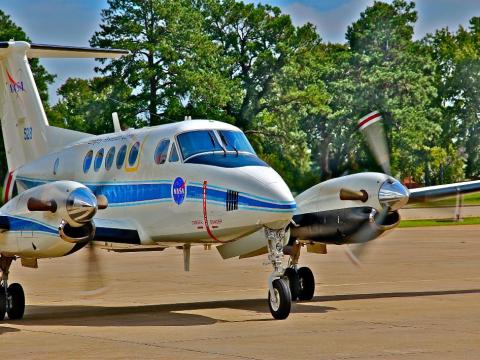
Development and Evaluation of Satellite Validation Tools by Experimenters (DEVOTE)
NASA Langley's UC-12 rolls toward a stop after a morning of flight research for evaluating the next-generation of satellite instruments that study aerosols – tiny chemicals and particles in the atmosphere.
The UC-12 flew high with two remote-sensing lidar (laser) instruments aboard, while Langley’s B-200 flew low taking in-situ, or in place, measurements with a suite of about 10 instruments.
"The remote-sensors on the aircraft are prototypes for future systems," said John Hair, principal investigator for DEVOTE (Development and Evaluation of satellite Validation Tools by Experimenters). "We want to evaluate the measurements with detailed in-situ measurements, ground station measurements, and satellite measurements."
The DEVOTE project is a training initiative lead by a team of early career scientists and engineers who are gaining mission experience and contributing to the latest Earth science research through a field campaign.
The project is sponsored by the Hands-On Project Experience, an initiative funded by the Office of Chief Engineer and the Science Mission Directorate at NASA Headquarters.
Credit: NASA/Mike Finneran
http://www.nasa.gov/centers/langley/news/researchernews/DEVOTE.html

ECO-3D to provide critical measurements on forest biomass structure and carbon
Forest ecosystems play an important role in the global carbon cycle by sequestering carbon dioxide from the atmosphere but also releasing carbon to the atmosphere upon decomposition. Currently, land imagers are able to provide important information on forest cover, extent, and condition, but knowing the 3-dimensional structure of vegetation is important for quantifying the amount of carbon stored in biomass. In an effort to develop new instruments for determining biomass structure, and to pave the way for future satellites such as DESDynI, the NASA P-3 is currently flying the ECO-3D mission over Maine, New Hampshire, Pennsylvania and Florida.
The primary payload, DBSAR, collects Polarimetric and Interferometric SAR data to validate biomass estimates in order to advance our understanding of the carbon cycle. DBSAR will also help advance the use of SAR for ecosystems while informing scientists about the potential of digital beam forming technology to map tree heights, forest biomass, and land cover type.
As part of the August campaign, NASA will also fly two other instruments, the Slope Imaging Multi-polarization Photon-counting Lidar (SIMPL), and the Cloud Aerosol Radiometer (CAR). SIMPL is a multi-beam, micropulse, single photon ranging laser altimeter (Fig. 2) that will provide measurements of forest canopy structure with very high spatial resolution (Fig. 2) and two-color polarimetry data that can be used to differentiate stand types. CAR is an airborne multi-wavelength scanning radiometer that can measure spectral directional reflectance over uniform forests, homogenous clouds, and bright targets. During this deployment, CAR will be employed to derive the Bidirectional Reflectance Distribution Function (BRDF) and the vegetation clumping Index.
Data collected with these instruments will be used to advance the development of algorithms for biomass estimation, and in particular, the lidar-radar fusion techniques to estimate biomass and vegetation structure. Of special interest, DBSAR’s InSAR phase coherence measurement of microwave scattering dispersion in forest canopies will be compared to the SIMPL canopy height and structure results. This assessment will be in preparation for the DESDynI mission, to ascertain if L-band phase coherence can be calibrated by lidar data to yield reliable mapping of vegetation height and thereby estimation of aboveground biomass.
Hurricane and Severe Storm Sentinel (HS3)
The Hurricane and Severe Storm Sentinel (HS3) is a five-year mission specifically targeted to investigate the processes that underlie hurricane formation and intensity change in the Atlantic Ocean basin. HS3 is motivated by hypotheses related to the relative roles of the large-scale environment and storm-scale internal processes. HS3 addresses the controversial role of the Saharan Air Layer (SAL) in tropical storm formation and intensification as well as the role of deep convection in the inner-core region of storms. Addressing these science questions requires sustained measurements over several years due to the limited sampling opportunities in any given hurricane season.
Common Operations and Management Portal for Airborne Science Systems (COMPASS)
The Common Operations and Management Portal for Airborne Science Systems (COMPASS) will support the Airborne Science Program (ASP) and the NASA Science Mission Directorate (SMD) Earth Science division by providing a suite of web-based enterprise management capabilities and improved situational awareness tools to support Airborne Science Missions. COMPASS will provide a common operating picture for improved situational awareness for all participants in NASA Airborne Science missions from scientists and engineers, to managers, as well as the general public. The intent of the system is to encourage more responsive and collaborative measurements between instruments on multiple aircraft, satellites, and on the surface in order to increase the scientific value of the measurements, and improve the efficiency and effectiveness of flight missions. At its most basic, the system will provide a means for visualizing the position of the aircraft and instruments during the course of the mission. Such information is made more useful when compared with or overlaid upon other datasets and model outputs used for mission planning and science data analysis. In addition to map-based information, COMPASS will enable communication between mission team members to enable analysis and discussion of multiple data sources in order to plan and execute science missions.