News

Operation IceBridge Hosts Distinguished Guests
U.S. Ambassador to Chile, Alejandro Wolff, and his Secretary for Economic Affairs, Josanda Jinnette, flew onboard the NASA DC-8 over Antarctica on October 25, 2012

NASA Radar Penetrates Thick, Thin of Gulf Oil Spill
Researchers at NASA's Jet Propulsion Laboratory and the California Institute of Technology in Pasadena have developed a method to use a specialized NASA 3-D imaging radar to characterize the oil in oil spills, such as the 2010 BP Deepwater Horizon spill in the Gulf of Mexico. The research can be used to improve response operations during future marine oil spills.
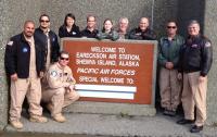
NASA C-20A Completes Radar Study of Pacific Rim Volcanoes
NASA's Airborne Science C-20A, carrying a synthetic aperture radar, recently completed a study of volcanoes in Alaska, Aleutian Islands and Japan.
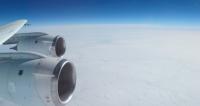
Operation IceBridge Resumes Antarctic Flights
Scientists and flight crew members with NASA's airborne mission to study Earth's polar ice are beginning another Antarctic campaign.

Students Invited to Connect with NASA Earth Explorers
NASA Earth explorers will take students on virtual trips around the world to inspire them to pursue science, technology, engineering and math careers.

NASA's ER-2 Checks Out Atmospheric Science Sensors
A NASA ER-2 is conducting engineering evaluations of and collecting science data with TWiLiTE and NAST-I atmospheric sensors.
HS3 Mission Thoroughly Investigates Long-Lived Hurricane Nadine
NASA's Hurricane and Severe Storm Sentinel scientists had a fascinating tropical cyclone to study in long-lived Hurricane Nadine. NASA's Global Hawk aircraft has investigated Nadine five times during the storm's lifetime.
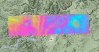
NASA Airborne Radar to Study Volcanoes in Alaska and Japan
NASA's Airborne Science C-20A, carrying JPL's UAVSAR sensor, travels to Alaska and Japan this week for a radar imaging study of active volcanoes.
Cutting-Edge Technology Makes NASA's Hurricane Mission a Reality
Scientists are currently flying a suite of state-of-the-art instruments that are gathering difficult-to-obtain measurements of wind speeds, precipitation, and cloud structures in and around tropical storms.

NASA Explores Underground Substructures Below Fault
The Sensor Integrated Environmental Remote Research Aircraft (SIERRA) allows scientists to explore hidden underground substructures below Surprise Valley fault.

High-Flying NASA Aircraft Helps Develop New Science Instruments
Over the next few weeks, an ER-2 high altitude research aircraft will take part in the development of two future satellite instruments.
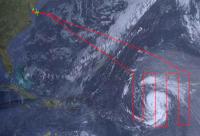
NASA Global Hawk Watches Tropical Storm Nadine's 'Birth'
Tropical Depression 14 strengthened into Tropical Storm Nadine while NASA's Global Hawk aircraft captured the event. While the Global Hawk was gathering data over the storm, NASA satellites were also analyzing Nadine from space.
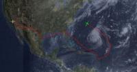
NASA's HS3 Mission Begins with Flight to Hurricane Leslie
NASA has begun its latest hurricane science field campaign by flying an unmanned Global Hawk aircraft over Hurricane Leslie in the Atlantic Ocean during a day-long flight that began in California and ended in Virginia.

Two Hurricane Global Hawks, Two Sets of Instruments
HS3 will study hurricanes at the end of the summer, flying two high-altitude, long-duration unmanned aircraft with different instruments over the storms.

NASA's New Way to Track Formaldehyde
Urban pollution, such as formaldehyde, that winds up in Earth's upper atmosphere can wreak havoc on the ozone layer.
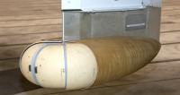
NASA ER-2 Collects Perseid Meteor Shower Dust
NASA's ER-2 is using underwing Large Area Collectors to collect cosmic dust during the Perseid meteor shower the second week of August.
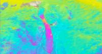
NASA Conducts Airborne Study of Colorado Landslide
Radar images of Colorado's centuries-old Slumgullion landslide from NASA's C-20A Earth science aircraft aid scientists' understanding of slide motion.

Hurricane Study a Challenge to Global Hawk Pilots
NASA's Hurricane and Severe Storm Sentinel mission will require Global Hawk pilots to fly the unmanned aircraft from two locations on opposite coasts.

When Wildfire Smoke and Thunderstorms Collide
The Deep Convective Clouds and Chemistry (DC3) airborne campaign got an up-close look at what happens when wildfire smoke makes its way into a thunderstorm.
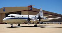
College Students Study the Earth From NASA's P-3B Flying Lab
Thirty-two undergraduate and graduate students are participating in a NASA Airborne Science Program field experience at NASA's Dryden Aircraft Operations Facility in Palmdale, Calif. this week designed to immerse them in the agency's Earth science research.

NASA C-20A Wrapping up Iceland Ice Caps Survey
Flight and ground crew of NASA's environmental science research aircraft host visit by U.S. ambassador to Iceland during stay in Keflavik.

Teachers Experience Arctic Research with IceBridge
During the 2012 Arctic campaign, teachers from the United States, Denmark and Greenland joined IceBridge researchers as they surveyed Greenland's sea ice, ice sheet and glaciers.
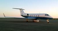
NASA Airborne Radar Studies Icelandic Ice Caps
A NASA science aircraft carrying a specially designed synthetic aperture radar is currently in Iceland as part of a study to derive 3D surface velocity fields for two of the country's ice caps.

NASA DC-8, NCAR G-V Continue Bumpy Science Flights
Two flying science laboratories fly around thunderstorm cores and anvil clouds over the central U.S. during NCAR's DC3 atmospheric science campaign.
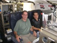
NASA Science Grips Two Brothers
Two principal researchers on several airborne sensors had more in common than conducting atmospheric research. Gerry and Andy Heymsfield are brothers.
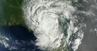
NASA Sending Unmanned Aircraft Over Hurricanes
Beginning this summer and over the next several years, NASA will be sending unmanned aircraft dubbed "severe storm sentinels" above stormy skies to help researchers and forecasters uncover information about hurricane formation and intensity changes.
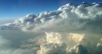
DC3 Thunderstorm Study Science Flights Underway
Complex environmental science campaign over central U.S. to aid scientists' understanding of how large thunderstorms affect atmospheric chemistry.

2012 Arctic IceBridge Complete
The NASA P-3 has returned home to Wallops Flight Facility after completing a record number of science flight hours for Operation IceBridge.
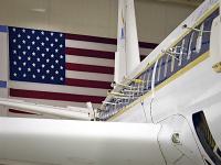
DC3: Chemistry of Thunderstorms
NASA researchers begin a campaign that will take them into the heart of thunderstorm country.
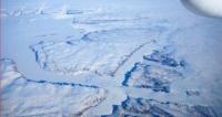
NASA's ER-2 Completes MABEL Validation Deployment
The weather, the aircraft and the science instruments cooperated to successfully validate data from the MABEL laser altimeter planned for IceSat-2.
