News
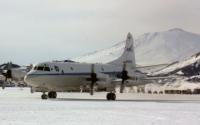
IceBridge's First Antarctic Campaign from McMurdo Station
The IceBridge mission will conduct daily survey flights through Nov. 26 on a NASA P-3 research aircraft from a base of operations at McMurdo Station.
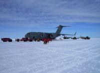
IceBridge Prepares for Mission of "Firsts"
Members of the IceBridge team arrived at McMurdo Station Nov. 12, 2013 aboard a U.S. Air Force C-17 transport aircraft.
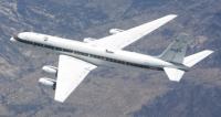
NASA's DC-8 Flying Lab Undergoes Major Maintenance
NASA's DC-8 Flying Laboratory will soon undergo "C Check" major maintenance as part of the aircraft’s new Low Utilization Maintenance Plan.
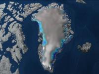
Airborne Campaign to Map Greenland Ice Sheet Summer Melt Begins
Operation IceBridge will carry out a first-ever campaign to gather data on changes in Greenland's ice following the summer melt season.
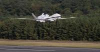
NASA Airborne Science Aircraft Complete Summer Deployments
Several NASA Airborne Science aircraft that were deployed for science missions during the summer of 2013 to study subjects from hurricane formation to forest fires have returned to their home bases at NASA's Dryden Flight Research Center and the Dryden Aircraft Operations Center in Southern California.
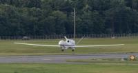
NASA's Global Hawks Mark 100th NASA Flight
High-flying, long-range aircraft mark milestone Sept. 17 while flying over the Atlantic on the HS3 hurricane formation and intensification mission.
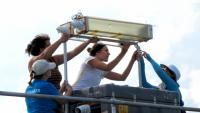
Measurements Underway in Houston for DISCOVER-AQ
Students and researchers from Millersville University, Penn State University and NASA are collaborating at Smith Point, one of the DISCOVER-AQ ground stations near Houston, Texas.

NASA HS3 Mission Animations Peer in and Outside of Tropical Cyclones
NASA's Hurricane and Severe Storms Sentinel or HS3 mission is flying two unmanned aircraft to explore tropical cyclones and their environment.
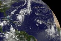
NASA Investigates Gabrielle's Remnants and New Tropical Storm Humberto
The remnants of the once-tropical-storm Gabrielle continued to struggle near the Bahamas as NASA's HS3 mission investigated.
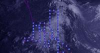
Global Hawk Data Used in National Hurricane Center Forecast of Gabrielle
Data from the dropsondes that are dispersed from one of NASA's Global Hawk unmanned aircraft assisted forecasters at the National Hurricane Center when analyzing the environment of newborn Tropical Storm Gabrielle at 11 p.m. EDT on Sept. 4.
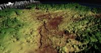
NASA Data Reveals Mega-Canyon under Greenland Ice Sheet
A study using data primarily from NASA's Operation IceBridge has found a canyon in the bedrock beneath Greenland's ice sheet that is longer than the Grand Canyon.
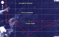
NASA's HS3 Mission Analyzes Saharan Dust Layer Over Eastern Atlantic
One of two of NASA's Global Hawk unmanned aircraft flew over the remnants of Tropical Storm Erin and investigated the Saharan Air Layer in the Eastern Atlantic Ocean on Aug. 20 and 21.
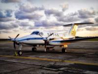
Major NASA Air Pollution Study to Fly Over Houston
A multi-year airborne science mission is on its way to Texas to help scientists better understand how to measure and forecast air quality from space.
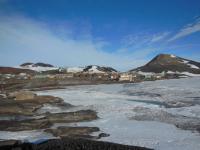
Change of Venue for NASA's IceBridge Antarctic Operations
For the first time ever, NASA's Operation IceBridge will fly scientific surveys out of McMurdo Station, Antarctica.

Learning by Doing: NASA's Airborne Research Experience for Educators
A dozen teachers from across the country came to Southern California for a 10-day Airborne Research Experience for Educators workshop at NASA Dryden.
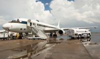
Search On for Climate Clues Across Southern U.S. Skies
NASA research aircraft began flights Aug. 12 from Houston's Ellington Field to investigate how the combination of summer storms and rising air pollution from wildfires, cities, and other sources can change our climate. Hoping to improve future predictions of climate change, scientists in the NASA study are using the skies over much of the southern United States as a natural laboratory this month and into September.
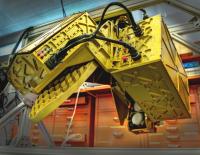
Seeing Which Way the Wind Blows
A new Doppler radar takes flight on this summer's HS3 mission.

Airborne Campaign Preparing to Probe Pollution-Climate Link
An eclectic assortment of sensors are installed on NASA's DC-8 and ER-2 aircraft to study how air pollution and natural emissions affect climate change.

Unmanned NASA Aircraft Crashes During Science Mission
NASA is investigating the loss of a small unpiloted aircraft over the Arctic Ocean Friday, July 26, while it conducted research on sea ice. The Sensor Integrated Environmental Remote Research Aircraft (SIERRA) was about four hours into a planned six-hour flight when it experienced a problem that caused it to lose altitude and crash in the ocean. The incident occurred at 6:15 p.m. AKDT (10:15 p.m. EDT).
The flight originated from Oliktok Point, off the northern coast of Alaska. The crash site is extremely remote, about 40 miles farther north in the Beaufort Sea. No one on the ground was injured. Environmental impacts at the crash site are expected to be minimal because of the aircraft’s small size. At the time, SIERRA had less than six gallons of fuel and oil aboard. A mishap investigation is underway.
The aircraft was one of three unmanned aerial vehicles taking part in a science experiment called the Marginal Ice Zone Observations and Processes Experiment (MIZOPEX). Mission objectives were to probe the ocean's role in recent declines in Arctic sea ice using a sophisticated set of radars and other instruments.
SIERRA was a medium-class, unmanned aircraft system with a wingspan of 20 feet and a weight of 400 pounds. It was designed to perform remote sensing and atmospheric sampling missions in isolated and often inaccessible regions, such as over mountain ranges, the open ocean, or the Arctic and Antarctic regions. NASA acquired SIERRA from the U.S. Naval Research Laboratory in 2006 and conducted its first mission surveying sea ice off the coast of Svalbard, Norway, in 2009. The vehicle was valued at $250,000.
For more information about SIERRA, visit:
http://airbornescience.nasa.gov/aircraft/SIERRA
For more information about the MIZOPEX mission, visit:
http://ccar.colorado.edu/mizopex/index.html
Ruth Marlaire
Ames Research Center, Moffett Field, Calif.
650-604-4709
J.D. Harrington
Headquarters, Washington
202-358-5241
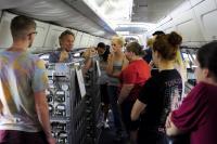
NASA's Student Airborne Research Program: Learning by Doing
32 college students in the 2013 Student Airborne Research Program were involved in every aspect of a NASA science mission over California.

Antarctic Glacier Calves Iceberg One-Fourth Size of Rhode Island
This week a European Earth-observing satellite confirmed that a large iceberg broke off of Pine Island Glacier, one of Antarctica's largest and fastest moving ice streams. The rift that led to the new iceberg was discovered in October 2011 during NASA's Operation IceBridge flights over the continent.
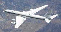
NASA's DC-8 Flight Helps Validate New Technologies
Flying laboratory carries several instruments testing new technologies that could aid Earth science missions, GPS accuracy and aviation safety.
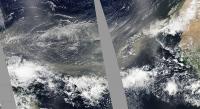
NASA's 2013 HS3 Mission to Delve into Saharan Dust
NASA's 2013 HS3 mission will investigate whether Saharan dust and its associated warm and dry air, known as the Saharan Air Layer favors or suppresses the development of tropical cyclones.
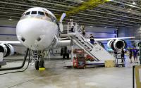
College Students Study The Earth From NASA's DC-8 Flying Lab
College students in NASA's Student Airborne Research Program (SARP) will measure pollution and air quality, study forest ecology and ocean biology around California.

NASA SEAC4RS Mission Targets How Pollution, Storms And Climate Mix
NASA's DC-8 and ER-2 science aircraft will take to the skies over the southern United States this summer to investigate how air pollution and natural emissions, which are pushed high into the atmosphere by large storms, affect atmospheric composition and climate.
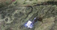
California Powerhouse Fire Image from NASA ER-2
The MASTER instrument on NASA's ER-2 high-altitude science aircraft captured this infrared image of the Powerhouse wildfire in the Angeles Forest near Lake Hughes, Calif., during a nighttime flight May 31-June 1.
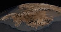
IceBridge Contributes to New Map of Antarctica
The new map's improved precision will lead to better calculations of Antarctic ice volume and its potential contribution to sea level rise.

NASA’s HS3 Mission Aircraft to Double Team 2013 Hurricane Season
NASA's HS3 airborne mission will revisit the Atlantic Ocean to investigate storms using additional instruments and for the first time two Global Hawks.

HS3 Mission May Target Cape Verde Island Hurricanes in 2013
NASA's multi-year Hurricane and Severe Storm Sentinel, or HS3, mission may explore tropical cyclones of Cape Verde origins when it takes to the skies again this August.
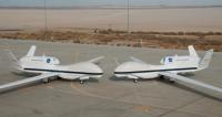
NASA, Northrop Grumman Continue Partnership For Science
NASA and Northrop Grumman extend a no-cost agreement enabling NASA to continue Earth science research with the Global Hawk unmanned aircraft system.
