
Leishmaniasis in Brazil: Landcover Classes
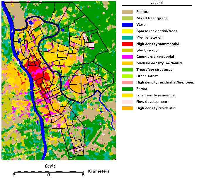
This landcover map was the result of a reclassification of an unsupervised
spectral classification of a Landsat TM image acquired 1995-10-18. The
original classification was used to generate thirty landcover classes.
Probable landuse-category seeds were then identified and used as input to
a kernel-based spatial reclassification
(SPARK)
algorithm. The modified SPARK algorithm uses landcover class adjacency to
reclassify an image. The boundaries of Teresina's 74 districts are overlaid
in black.
 Back to
CHAART NIH Leishmaniasis in Brazil First Year Report
page
Back to
CHAART NIH Leishmaniasis in Brazil First Year Report
page
Last updated: 6 May 1999